


Welcome to Amboy, California. Population: 0
Amboy, on fabled Route 66 in the Mojave desert, hangs on as an unlikely tourist attraction. Neighboring towns didn't survive when they were bypassed by Interstate 40.

Today's interstate highways are a marvel. They make it possible for goods and humans to travel in comfort and safety vast distances at high speed on excellent roads. They are America's leisure and economic circulatory system. But it came at a cost. With the advent of the interstate highway system in the 1950's, many of the nation's old highways were turned into backroads and the small towns that had developed and prospered along their paths became backwaters. Some of those towns withered. Some of them died.
I took Highway 95 south from Las Vegas, then west onto Highway 66, better known as Route 66, near the California-Nevada state line. The two-lane highway undulated almost rhythmically but was otherwise fine. I came to the town of Goffs, or so the sign said. All I saw was a small farm strewn with dilapidated equipment and a few houses, some of which looked uninhabited or uninhabitable. I saw no people. I saw no evidence of people.
Fenner, California
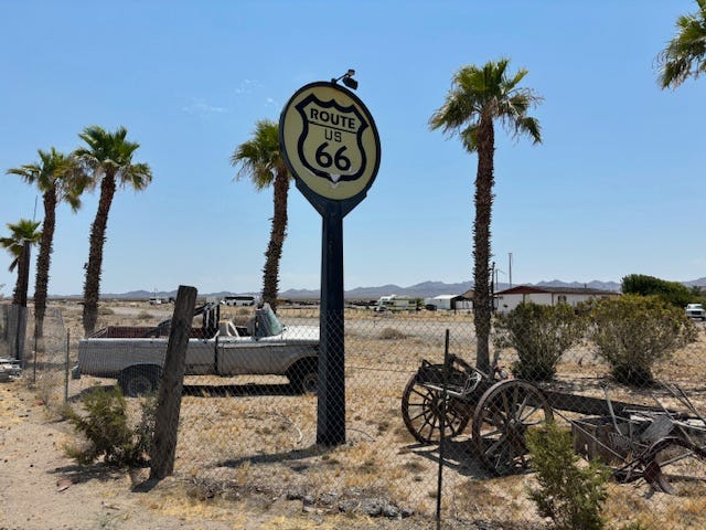
From Goffs, I continued another ten miles until I came to a Chevron station in the town of Fenner. Except Fenner isn't a town. Not anymore. It's just the gas station and a dirt yard surrounded by a chain-link fence containing a few metal carcasses of vehicles. Inside the fence, there was a pole about 20 feet high with a sign at the top with the old shield logo U.S. Highway 101 sign. On the other side of the gas station and yard was Interstate 40 where cars and trucks whizzed by. Fifty years ago, I-40 replaced Route 66. Some of the old highway became interstate. In other places, the new interstate detoured around it.
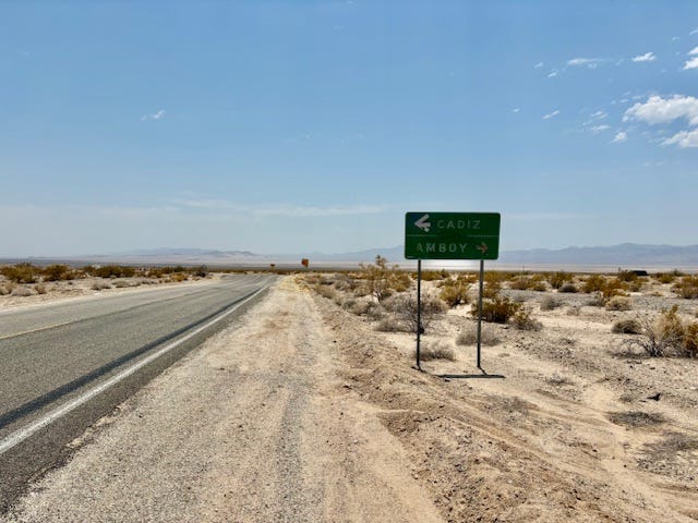
According to my Auto Club map, Route 66 ran west from Fenner through a succession of small towns. Essex. Chambless. Amboy. Bagdad. Siberia. Klondike. But when I tried to continue, the road was blocked by a barrier with a sign saying it was closed. Only later would I learn that it had been closed since 2017. Disappointed but undaunted, I got on I-40 and drove 45 miles to reach a road that cut south and connected to Route 66
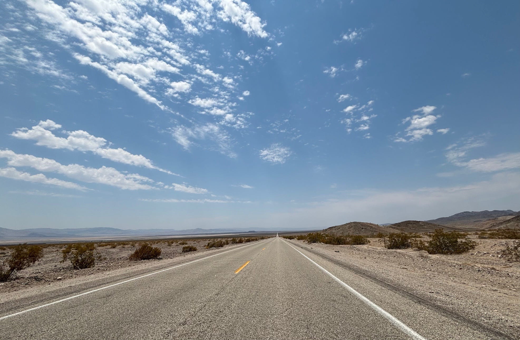
An hour later, I was back on Route 66 heading west toward Amboy. To my left for as far as I could see there was a huge desert plain that tilted down for many miles and then rose again toward the base of a mountain range almost the length of the horizon. In the near distance, a long chain of boxcars moved lazily eastward on a rail line. The sun beat down mercilessly.
"66 goes on over the terrible desert, where the distance shimmers and he black center mountains hang unbearably in the distance," wrote John Steinbeck about this patch of the Mojave Desert in The Grapes of Wrath in which the Joad family made the long trek west on Route 66 to escape Dust Bowl Oklahoma.
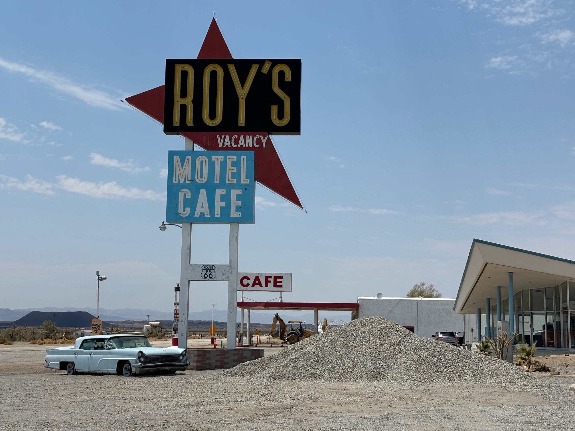
I reached Amboy. It consisted in its entirety of Roy's service station, the adjoining cafe, a motel (closed) and a small post office (permanently closed). An ancient sedan sat in front of the motel. A man stood on the edge of the highway taking a photo of the service station. A handful of cars were parked in the shade next to the cafe.
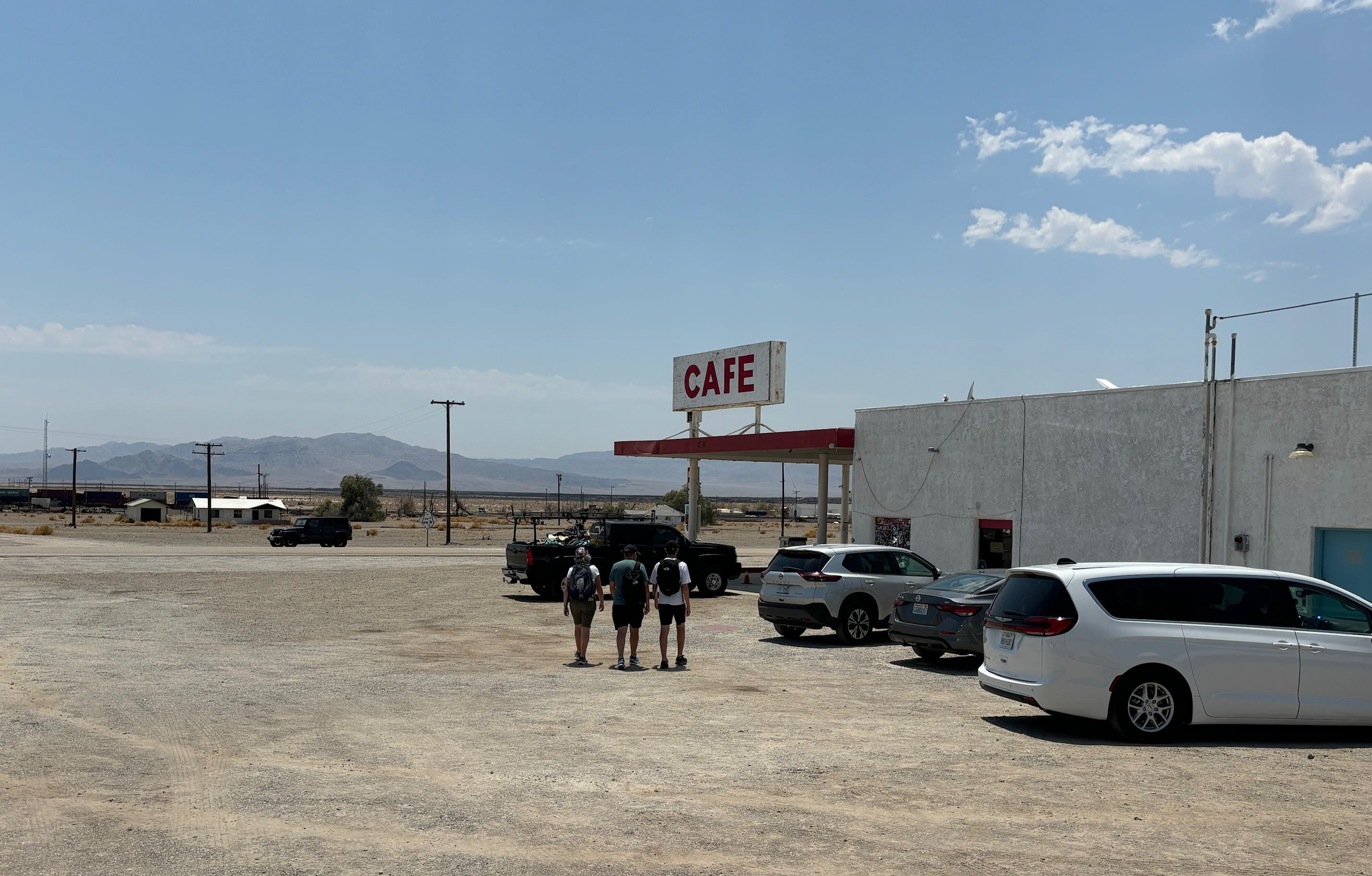
Many of the visitors to Amboy are European tourists
I parked, got out, and was immediately blasted by the furnace-like heat. It was 109 degrees. Inside the cafe, it was air conditioned to a blissful chill. I looked around. All kinds of Route 66 trinkets, decals, postcards and souvenirs were on display. A long counter ran almost the length of the room in back. I approached the woman behind the counter.
"Do you serve lunch?" I asked. I hadn't eaten all day.
She smiled apologetically. "Not in about three decades," she said.
Amboy was once a thriving little town. Roy Crowl opened the gas station, adjoining cafe and motel in the 1920's. In the heyday of Route 66 after the Second World War, Amboy had a population of a few hundred. But then Interstate 40 bypassed it and Amboy and all the little towns along this slice of Route 66 went into steep decline.
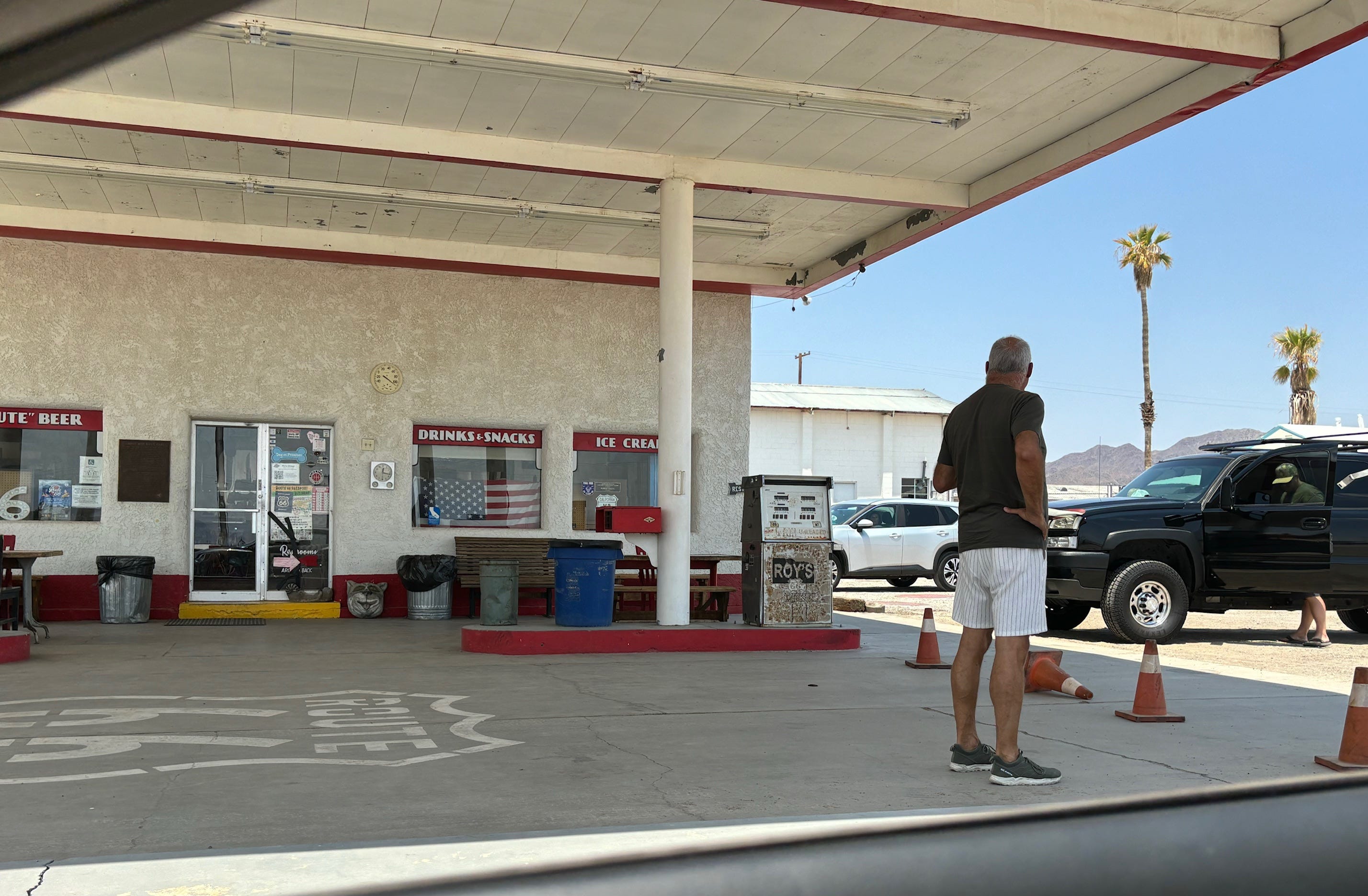
Roy’s, which is 100 years old, still sells gasoline, souvenirs and snacks
The woman behind the counter gave her name only as Ms. Nicole. She said she was assistant manager. I bought a souvenir postcard. We talked. Ms. Nicole said she lived in Twenty-nine Palms and had been the assistant manager for the past three years. She said they get a steady flow of visitors, many of them Europeans who'd heard about Route 66 and wanted to see it for themselves. She said the owners of Roy's were renovating the motel next door. The old motel lobby was already finished and furnished to look like it did in the 1950s. The motel and cabins are slated for renovation, with a target date of 2026 for occupancy.
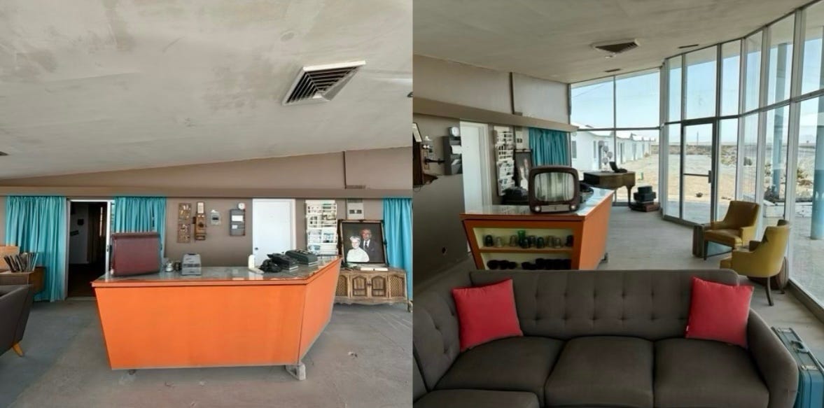
Roy’s motel lobby
"We get people calling all the time asking how much are the rooms," Ms. Nicole said.
I said, "But what would they do? No offense."
.
Ms. Nicole said the area was great for stargazing because it's so dark at night. There is also an extinct volcano, Amboy Crater, that people can hike to, and Joshua Tree National Park was just an hour south.
I asked what the deal was with the towns to the east on the closed road.
"There's what used to be towns," she said. "No people."
In fact, the population of Amboy is 0. But it lives on as Roy's. It's owned by a man named Kyle Okura who inherited it from his father. His father bought the entire town about 20 years ago from the family of its original owners. hoping to revive it as a tourist attraction. His father, Albert Okura, died last year.
"When Amboy came along, he [his father] kept telling himself, 'It is my destiny,'" Kyle Okura told the Los Angeles Times. "So I do believe that now, moving forward, it's part of my destiny to honor that."
Ludlow, California
I left Amboy and continued west past where Bagdad, Klondike and Siberia were marked on my map. I saw nothing. It was as if they had been erased from the landscape.
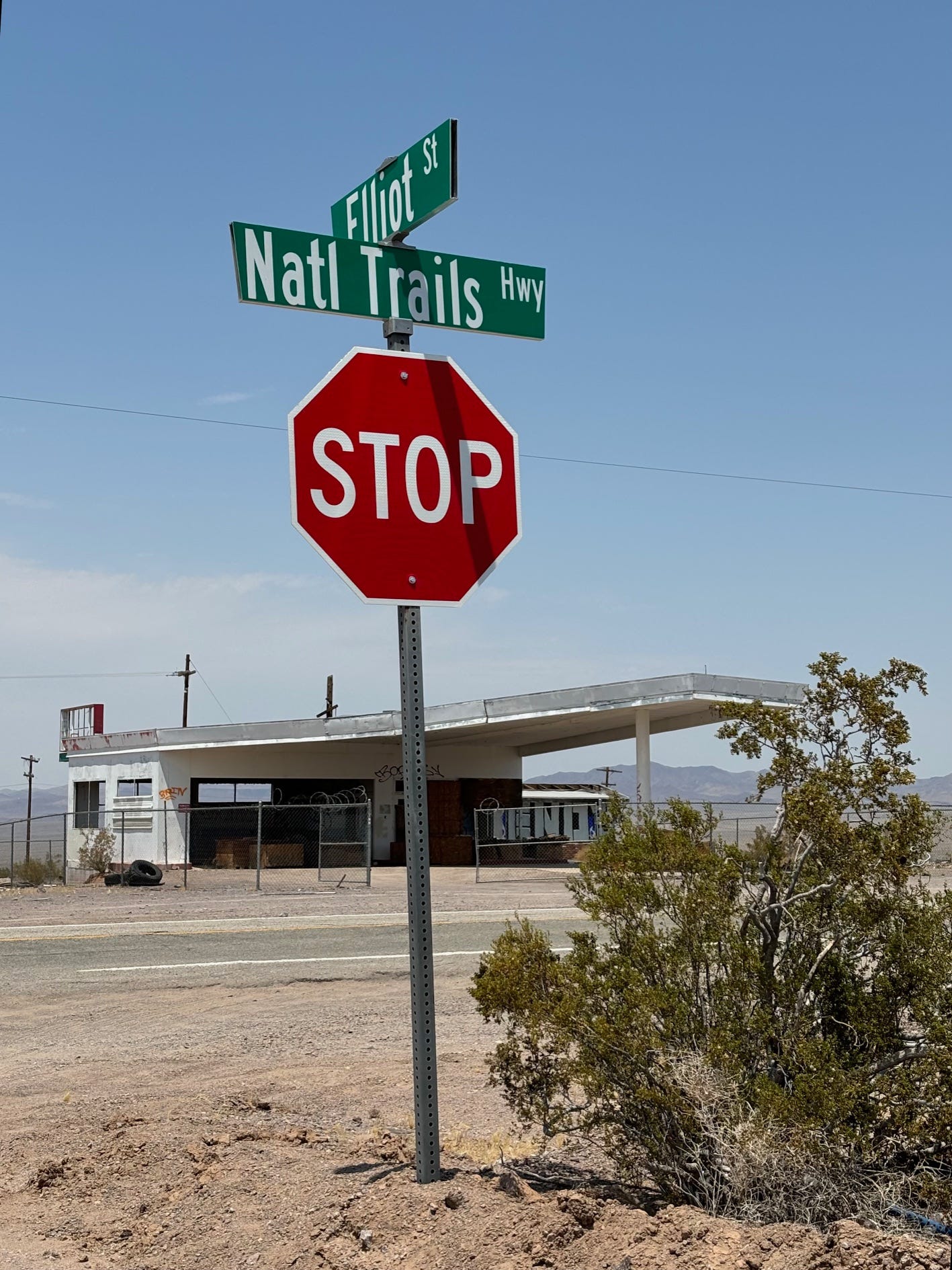
Finally, I reached Ludlow where Route 66 merges with I-40. There was a scattering of derelict buildings, but a short distance away was a modern service station, a restaurant and a hotel. They existed to service travelers on the interstate. Ludlow had survived, barely.
Route 66 (it was officially decommissioned in 1984 and is now the National Trails Highway)
That's not the end of Route 66 (officially, it's now called the National Trails Highway). It reappears about 40 miles west of Ludlow and continues intermittently to the Pacific Ocean. It's mostly just a lonely road now pointing toward Los Angeles and the setting sun. Its real destination is one you can't reach. The irretrievable past.